Navigating the Crocodile-Infested Nyabarongo, Akanyaru, and Akagera Rivers
Initially, the plan was to travel from Rwamagana to Bugesera via Rubona Junction. But the need to pick up more donations (books) made it necessary to pass by Kigali. From Kicukiro, I crossed the Akagera River and proceeded to Ntarama. Then I rode downhill to the confluence of the Nyabarongo and the Akanyaru Rivers.
The merging point of the Akanyaru and the Nyabarongo is an intriguing location. The merger of the two rivers gives birth to the Akagera River. The latter flows to Lake Rweru before continuing as the Kagera River. The Ruvubu River joins the Kagera near Rusumo Falls. Kagera, in turn, empties into Lake Victoria. I don’t think I have ever mentioned so many water bodies in one paragraph before.
Many moons ago, I came to my motherland through the Kagera River. The first attraction I saw in this remarkable destination was Rusumo Falls, found at the border with Tanzania. At the time, I didn’t know where the Nyabarongo turns into the Akagera and, eventually, the Kagera.
Before I ventured into travel writing, I thought the Nyabarongo River flowed from Nyungwe Forest all the way to Lake Victoria. As the ongoing expedition picks up steam, my familiarity with the region’s geographical features is improving significantly.

The confluence of the Nyabarongo and the Akanyaru rivers
Over the past seven years, I have learned one or two things about the intricate network of tributaries that form the headwaters of the Nile. In 2020, while riding along the Karongi stretch of the Congo Nile Trail, I found out that the Nyabarongo River begins where two rivers, namely Mbirurume and Mwogo, meet. Although I was viewing them from a distant hill, I saw the two tributaries merging to form the longest river in Rwanda.
About a year later, I set foot on the bank of the Akagera River for the first time. This happened during an exhilarating off-road adventure ride from Ngoma to Bugesera. It was the discovery of the Akagera River that influenced my decision to find its source.
So far, I have written a lot about the Nyabarongo. Rwanda’s most popular river flows through all five provinces, forming provincial boundaries along the way. I cross the river quite often during my many tours within the Land of 1,000 Hills.
I can’t say the same about the Akanyaru River. There is a good chance I had never seen it before I embarked on my ongoing tour. If I had, I must have thought it was another stretch of the Nyabarongo. After all, my ignorant self used to refer to every river in Rwanda as Nyabarongo.

The Akanyaru River
Where is the source of Akanyaru River? While preparing for this tour, I tracked its course on Google Maps towards the opposite direction. I usually explore rivers backwards, from mouth to source, instead of the other way around. On the map, I saw it meandering in and out of Burundi before disappearing in the deep south.
If the point of disappearance marks the beginning of its flow, then the source of Akanyaru River is in Rwanda. The river zigzags in and out of the country all the way to Bugesera.
A number of smaller rivers pour into Akanyaru. These include Nyarubogo, Muvugutu, Mukunguri, Kaduha, and Agasasa.
From my Ntarama entry point, I marveled at both the Akanyaru and the Akagera rivers. However, the view of Nyabarongo was obstructed by an islet formed at the confluence. In a bid to take a closer look, I sought the services of a local boat operator and navigated the three crocodile-infested rivers.

The Akagera River
The wider marshland area is a sugarcane plantation. On the bank of the river, a handful of young people were loading a big truck used to ship harvested sugarcane to the factory.
Some kids were swimming in a pool formed by a broken river bank. "Aren’t you afraid of the crocodiles?" I asked them. "No, our swimming pool is not in the crocodile zone." They assured me that they were safe. That begs the question: Did I risk my life sailing in a crocodile habitat? The boatman dismissed my concerns. However, he acknowledged the presence of man-eaters in his office.
Members of the communities living near these rivers do not take safety measures seriously, in my opinion.
A couple of years ago, I visited the viewpoint overlooking the confluence of the Nyabugogo River and the Nyabarongo River, the same spot I marveled at while hiking Kanyinya Hill at the beginning of this tour. From there, I rode along a trail snaking adjacent to the Nyabarongo all the way to Gakenke. During a stopover in a small riverside settlement in Rulindo, I saw a few young men washing motorcycles and trucks on the edge of the river. Some of them were partially submerged in the water. Again, I wanted to know if they weren’t afraid of falling prey to the Nyabarongo predators.
"This pool is formed by a broken river bank. Although its content is from Nyabarongo, it doesn’t match the natural conditions preferred by the crocodiles." One of them educated me. The rest nodded in agreement. Their reasoning didn’t make sense to me, but I am sure they know better.
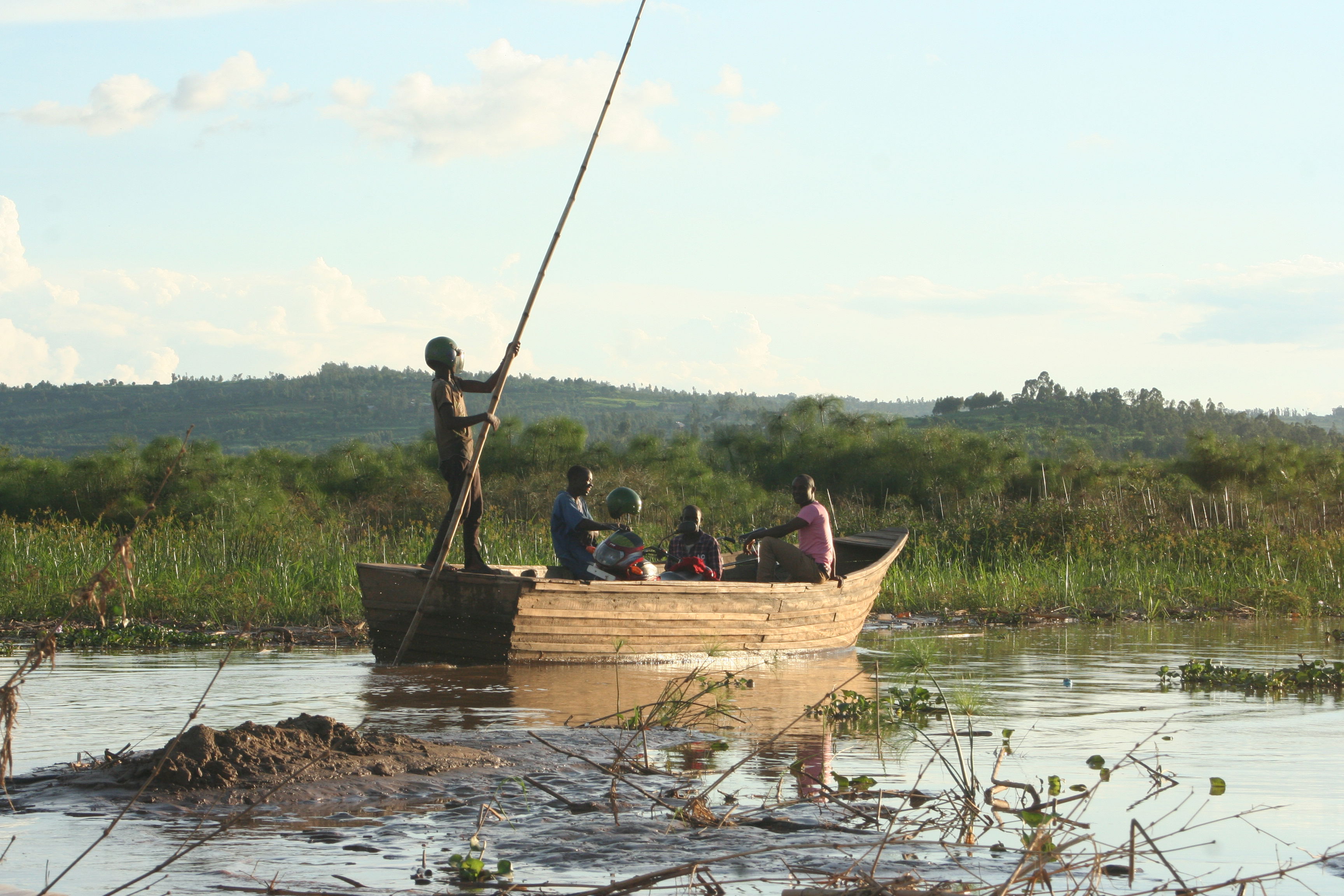

My boat operator and his crew