Muhazi Dyke: The Engineering Masterpiece Designed to Support Nature, Livelihoods, and Tourism
In the beginning of my ongoing adventure ride around Lake Muhazi—a calm, narrow water body straddling five districts—I found myself unexpectedly drawn to an intriguing structure: Muhazi Dyke. The project was implemented to regulate water flow, prevent flooding, and support sustainable agriculture around the lake. It is a testament to human ingenuity in response to the need to obey nature's rhythm without compromising our survival.
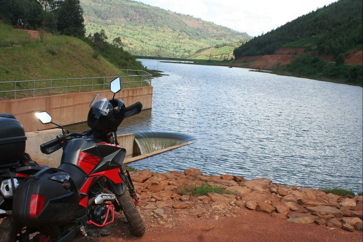
Muhazi Dyke is the lake's only visible outlet, and the source of Nyabugogo River, which flows into Nyabarongo River. That begs the question: could there be rivers flowing into Lake Muhazi? Based on my initial, surface-level research, the answer appears to be no.
As my tour around the lake unfolds—inspecting every twist and bend of its shoreline—I am determined to verify that claim firsthand. If it turns out to be true that Muhazi has no inlets, then how does it release such a steady flow of water continuously without seeming to run dry? This question has transformed a leisurely sightseeing ride into a deeper environmental investigation. Over the course of the expedition, I will try to uncover the lake's hydrology and lay out the delicate balance that sustains it.
As my tour around the lake unfolds—inspecting every twist and bend of its shoreline—I am determined to uncover the lake's hydrology and lay out the delicate balance that sustains it.
Lake Muhazi may look peaceful—its waters stretching out like a shimmering ribbon—but underneath that calm surface is a history of struggle. For years, during heavy rains, the lake would pour out too fast, sending water rushing downstream and flooding parts of Kigali, especially the busy Nyabugogo commercial area.
To make matters worse, during the dry season, the lake levels could drop so low that fish farmers’ cages would hang in midair, and water pumps for irrigation would be left useless. Local agriculture suffered. The fisheries struggled. Even sugar cane plantations downstream were at risk.
That’s where this new dyke comes in. Built at a cost of Rwf 3 billion (approximately USD 2.1 million), the dyke now regulates how much water leaves the lake. It holds back the floods during the rainy season, and keeps enough water in the lake during the dry months to support farming, fishing, and domestic use.
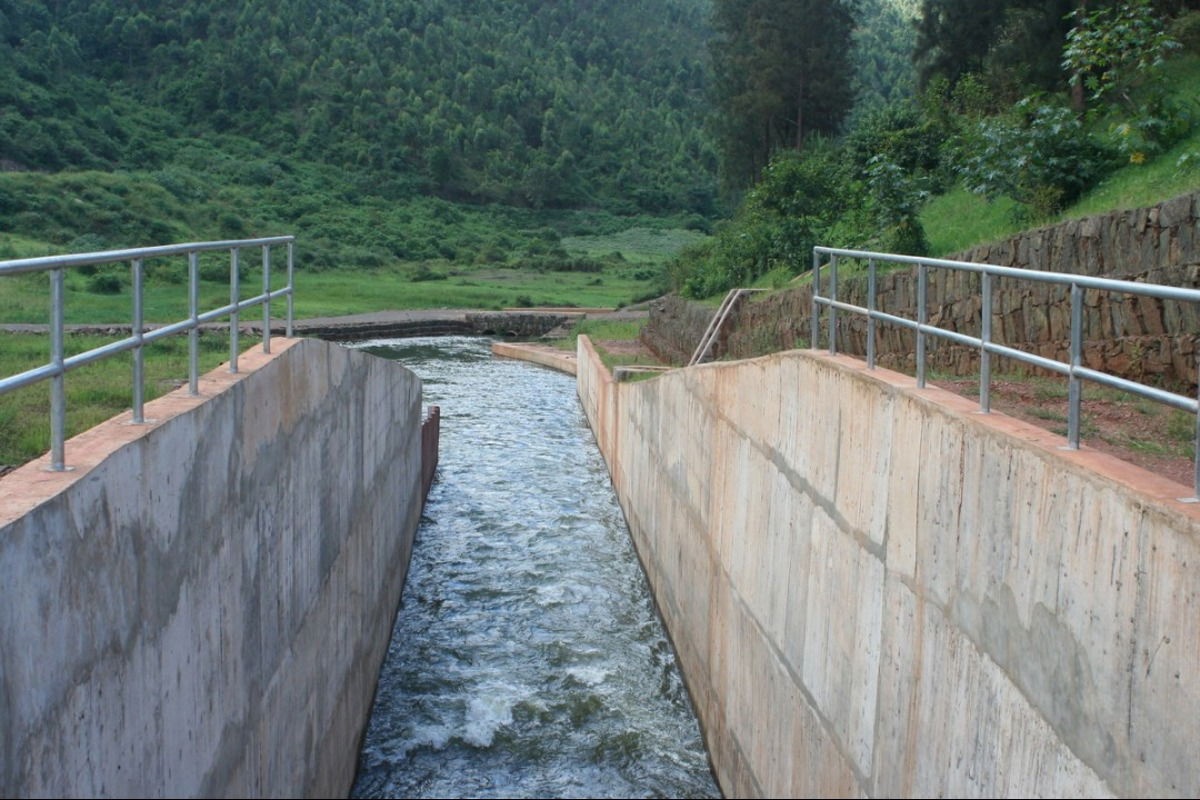
Built at a cost of Rwf 3 billion (approximately USD 2.1 million), the dyke now regulates how much water leaves the lake. It holds back the floods during the rainy season, and keeps enough water in the lake during the dry months to support farming, fishing, and domestic use.
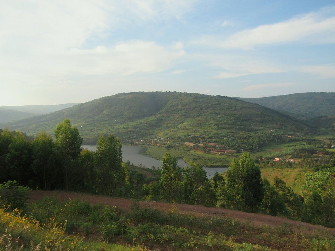
Over the years, people have talked about the untapped potential of this lake. Spanning the length of about 50 kilometers, the narrow, uniquely shaped water body has all the ingredients for a world-class getaway: scenic surrounding hills, rich biodiversity, and a deep cultural history.
Legend has it that Rwanda’s founding monarch, King Gihanga Ngomijana, descended from the heavens and settled near these shores. Yes, you read that right. According to folklore, Rwanda's first king fell from the sky. The area believed to be Rwanda's birthplace is not far from the dyke I am standing on.
With this engineering marvel in place, the foundations are now being laid—literally and figuratively—for sustainable development. The government’s tourism master plan for the area includes some bold ideas: beach facilities, water sports, an amusement park, even a five-star hotel and a casino. It’s clear that the Muhazi Belt has finally attracted the attention it deserves.
Legend has it that Rwanda’s founding monarch, King Gihanga Ngomijana, descended from the heavens and settled near these shores.