Hello Togo
The first thing I noticed upon arrival was light traffic. In Lomé, the capital of Togo, traffic flows as seamlessly as the water along the course of the Nile. That’s good news. The last thing I need is to get stuck in traffic while visiting different attractions in the city and beyond.
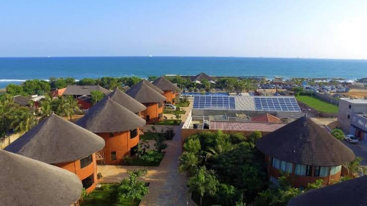
Togo’s 51-km coastline is embellished with sandy beaches and coconut trees. The country is sandwiched between Ghana and Benin. Ghana is so close to Lomé that you can find yourself there while taking a leisurely walk. Apart from Ghana and Benin, Togo borders Burkina Faso.
Before the Berlin Conference, present-day Togo was an intermediate zone between Asante and Dahomey states. When the scramblers of Africa sat down in 1884, they named the zone Togoland and put it under the German protectorate. After WWI, following the victory of the allied forces, the League of Nations assigned eastern Togoland to France and the western portion to Britain.
In 1946, the British and French colonial governments placed the land under the trusteeship of the United Nations. Ten years later, British Togoland was incorporated into the Gold Coast, while the French part became an autonomous republic within the French Union until independence in 1960.
There are 41 ethnic groups in Togo. Whilst French serves as an official language and lingua franca, each ethnic group has its own language. Widely spoken indigenous languages include Ewe and Kabiye.
Almost 50% of the Togolese are Christians, the majority being Roman Catholics. Muslims constitute about 14% of the population. More than 30% of the Togolese people are still practicing their ancestral beliefs.
Togo is divided into five regions. The said regions are Savannah, Kara, Central, Plateau and Maritime. My expedition in Togo will only feature the Maritime Region, which is part of the Gulf of Guinea. In this section, I am sharing my experiences in the Maritime Region of this enchanting destination.